 |
Geology
Physical Geology, Earth History, Oceanography, Environmental Geology
A short list of our geology field trips
Field trip leader: Dr. Alessandro Grippo, Ph.D.
|
Field activities are encouraged at Santa Monica College. As a geologist, I thrive in the field and I enjoy sharing my passion with students. I believe that you learn more during one day in the field than during a a week in the classroom. A few years ago (Spring 2007) I revived the Field Geology / Geology of California class (Geology 35). The class has been offered on and off in tehse years but I always pride myself in taking students out. In these years I have taken several groups of students to different areas of California and Nevada to look at different features and explore different aspects of geology and oceanography. Here is a quick list of some of the trips, with a few links to significant images.
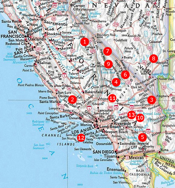
Modified from © National Geographic TOPO software
The Owens Valley: obsidian, tuff, rhyolites: a volcanic rock galore accompanied us throughout our trip into the glaciated eastern margin of the Sierra Nevada, all the way to Mammoth and to Mono Lake.
The San Andreas Fault: seeing and studying the most famous California's fault movement patterns in the Carrizo Plain. We went across this plate boundary and observed the North American plate and the Pacific plate right across the point where they touch each other. On the way to it, we stopped at the Wheeler and Sespe Gorges and along the banks of the Cuyama River.
The Mojave National Preserve: Cambrian oncolites, Paleozoic rocks, the Mitchell Cavern, the Amboy Crater basaltic volcano, disconformities and angular unconformities, the Kelso Sand Dunes, and historical Route 66 too! A trip to a relatively unknown National Park, a California gem.
Gem-O-Rama: a trip to the annual event in Trona, California. Exploring the world of evaporites, and collecting them too: hanksite and the famous pink halite become available to scientists and collectors alike just once a year, when Searles Lake is opened to the public .
The Salton Sea: An opening crust: the transition from divergent to transform margin. Viewing and discussing the San Andreas Fault and a very thin continental crust, rhyolite and obsidian domes, mud volcanoes, the Algodones sand dunes, slot canyons, and geothermal wells .
Death Valley, part I: classic Basin and Range geology: a trip that explored the main geological features of Death Valley National Park, from Furnace Creek to Badwater, from the Mesquite Sand Dunes to the Devil's Golf Course. Hiking narrow canyons and studying salt and mud on the playa .
Death Valley, part II: the Eureka Sand Dunes: not far from the eastern margin of the Sierra Nevada, the remote Eureka Valley with its giant sand dune, and Ubehebe Crater were the main attractions of this trip, that also included the exploration of a sulfur mine and lower Paleozoic limestones
Arrow Canyon, Nevada: The Carboniferous Period and System. An international scientific site that hosts the stratotype section for the Mississippian-Pennsylvanian boundary. A trip that allowed us to put a finger on the fourth dimension and "touch time". Add to that some beautiful stromatolites from Nevada's Bowl .
Death Valley, part III: the Racetrack: 54 miles on a 4WD road took us to one of the least understood features of Death Valley. In the Racetrack, stones fall from a cliff and seem to be "sailing" around, changing direction, leaving sometimes contorted patterns on the cracked mud of the playa. Stops on the way to the Racetrack included Red Rock Canyon, the Fossil Falls, the Owens Lake, the desert oasis of Darwin Falls, a view of the Lake Hill inselberg and the Panamint Sand Dunes, an incredible hike in Mosaic Canyon, the Mesquite Sand Dunes, the Devil's Cornfield, giant alluvial fans and bajadas, Ubehebe crater again, impressive fault scarps, and rocks of all kinds. See for yourself while browsing some images from this trip .
The Marble Mountains: A place that shows the ancient flooding of the North American carton, a very old continent (1.2 billion years old) slowly submerged by Cambrian time, showing the progression of the flooding, from land interior, to a coastline marked by beaches, to a deep ocean marked by muds, and finally to a carbonate sequence, all loaded with fossils.
Rainbow Basin: At this place, rocks do not seem real. Rocks do not bend, they break. But at his location, oh yes they do bend. They form a beautiful structure called a syncline that looks like the pages of an open book. And those layers do tell a story, like a book does!
Catalina Island: Taking a boat and landing on an island, close to the coastline but where we do not really get to go much. Thanks to a grant, we have been able to stay three days on Catalina, exploring its geology and experimenting with life, chemistry, and physics of the ocean. Working in the field, in the lab, and in the classroom, and discovering the beautiful blue schists of Catalina Island.
Amboy Crater: A cinder cone, a volcano in the middle of the Mojave Desert. Why is it there, what rocks do we see around it, what can we say about its origin? We took this trip in Fall 2017 and it was a blast. I also taught Geology of the Amboy Crater for the Desert Institute at Joshua Tree National Park
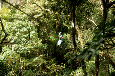
(no, we did not do that in the field.. that was just me in Costa Rica..)
|
Go to the Main Page | Go to the Images page
© Alessandro Grippo, since 1994, Los Angeles, California
last updated: February 14, 2017
|